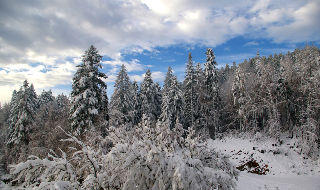
1. Delnice
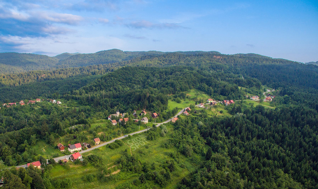
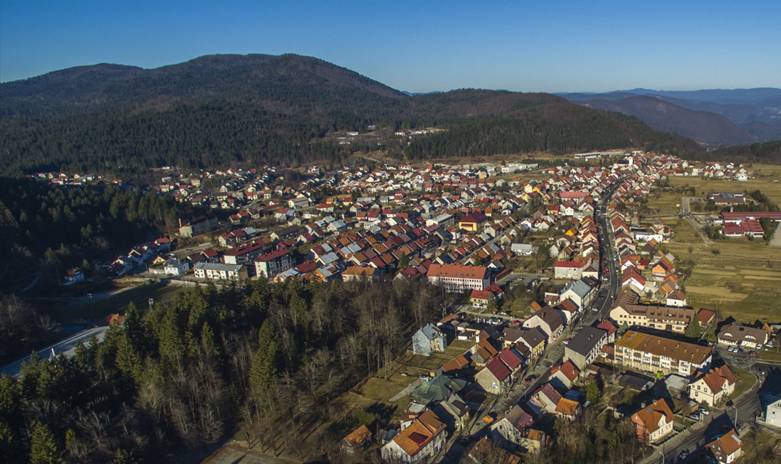
Delnice is the central, largest town of Gorski Kotar mountain region. At an altitude of 730m, Delnice is the highest town of Croatia. The town is home to approximately five ...
Delnice
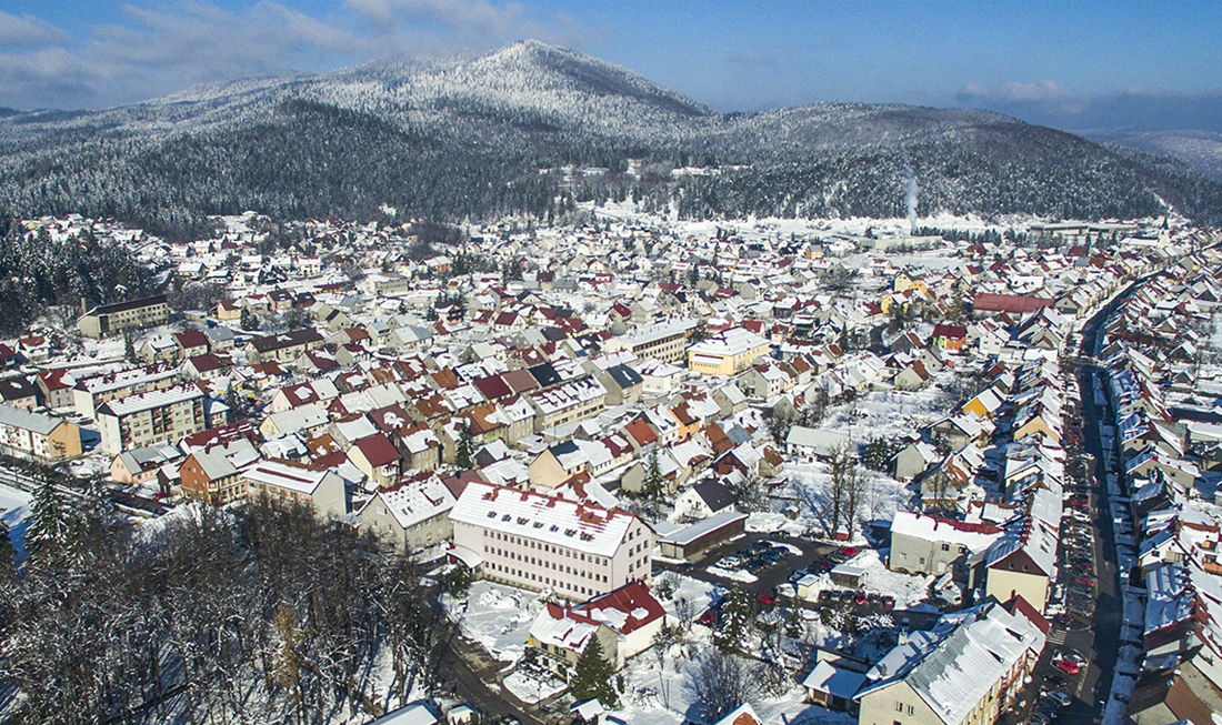
Delnice is the central, largest town of Gorski Kotar mountain region. At an altitude of 730m, Delnice is the highest town of Croatia. The town is home to approximately five thousand people. Delnice is a quiet town, away from the crowds, surrounded by the mountains covered with the fir. Here you can enjoy the fresh pine aroma in the air. The town is approximately thirty minutes away from the Adriatic Coast. This is the ideal starting point from which you can combine and explore the mixture of beautiful mountains and the crystal clear Adriatic sea either via hiking, cycling, rail, bus or by car. Delnice attracts enthusiasts of fresh mountainous climate as well as those who enjoy outdoor life and recreational sports, making this an ideal spot for an active and healthy holiday. Due to its altitude and clean air, Delnice is also a popular location for fitness training. After exploring numerous paths you can relax and refresh in coffee bars or restaurants and taste the local cuisine. The people are warm and welcoming. Along the Supilova High Street, you may spot the traditional mountain houses alongside with a few local shops. In the late autumn and winter Delnice is usually covered in much fog due to the river valley of Kupa nearby from which fog rises. Over the snowy winter months, you can enjoy outdoor activities such as skiing, snowboarding, sledding, ice skating. Come and explore Delnice where you will feel welcomed in our hotels, huts or private accommodation.
Access routs
Runolist, Jaglac, Zvjezdasti ljiljan, Tetrijeb gluhan, Sova ušara, Ris, Smeđi medvjed, Šojka kreštalica, Krstokljun, Šumarica, Planinska sova, Ciklama
2. Pijaničevo
Pijaničevo walking forest trail leads towards Japlenški vrh. Due to its close proximity of the town, it is a popular location for recreational walkers, runners and those who enjoy the ...
Pijaničevo

Pijaničevo walking forest trail leads towards Japlenški vrh. Due to its close proximity of the town, it is a popular location for recreational walkers, runners and those who enjoy the nature nearby the town.
Access routs
Jaglac, Zvjezdasti ljiljan, Tetrijeb gluhan, Sova ušara, Ris, Šojka kreštalica
3. Japlenški vrh
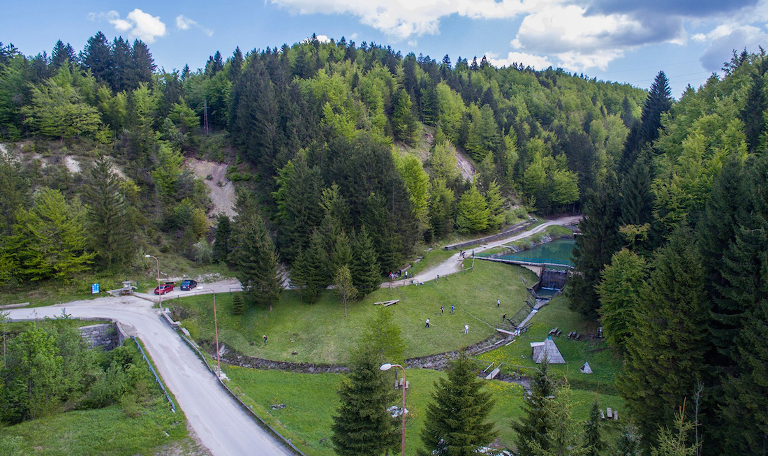
Forest park Japlenški vrh is located 842 m above sea level. This area of 170 hectares is located on the west side of Delnice town. Here you can enjoy protected ...
Japlenški vrh

Forest park Japlenški vrh is located 842 m above sea level. This area of 170 hectares is located on the west side of Delnice town. Here you can enjoy protected nature environment. At the very bottom of the peak, there is a park area, which has a deer enclosure. Choose one of many walking paths to enjoy a quiet relaxing walk or an exhilarating run. Stop at The Hunters Lodge (Lovački Dom) restaurant to enjoy local cuisine and drinks. On the northeastern side look out for the 70m ski jump slope which use to host competitions. Here you have a great view of the town. The Ski Jump slope is currently awaiting reconstruction which would allow it to host many more competitions in the near future.
Access routs
Jaglac, Zvjezdasti ljiljan, Tetrijeb gluhan, Sova ušara, Ris, Šojka kreštalica
4. Mikulaškova špilja
Mikulaškova špilja is an unexplored cave halfway between Traven vrh and Pola puta (the path on the forest road towards Praprot), in the area of Paradeći Lomi. This location was ...
Mikulaškova špilja

Mikulaškova špilja is an unexplored cave halfway between Traven vrh and Pola puta (the path on the forest road towards Praprot), in the area of Paradeći Lomi. This location was named after a local forest ranger Slavko Pleše (Mikulaškov) who devoted much of his time to care and maintain this forest area.
Access routs
Zvjezdasti ljiljan, Tetrijeb gluhan, Sova ušara, Šojka kreštalica
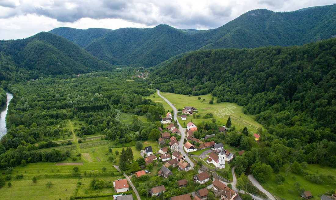
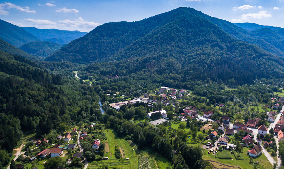
5. Crni Lug
The picturesque village of Crni Lug village is located at an altitude of 726m. It is surrounded by forests of fir, spruce, and beech. The village enjoys an alpine climate ...
Crni Lug

The picturesque village of Crni Lug village is located at an altitude of 726m. It is surrounded by forests of fir, spruce, and beech. The village enjoys an alpine climate with snowfall during winter. Summers are warm. Walking through the village you may notice the traditional mountain style houses. The traditional material used is wood and the specialized technique is called Šindra. This unique craftsmanship of using and shaping the wood to cover the roofs and facades is certified as cultural heritage and its still being used today. Here, one kilometer from the village is an entrance and the headquarters of National Park Risnjak, where you can find information and trail maps of the area. Do not miss out on walking the educational Leska trail to learn about the flora and fauna and if you are very quiet, you can even get a glimpse and a sound of local wildlife. From here you can hike via Schlosserov Dom (Schlosser’s Hut) trail to reach a magnificent Risnjak peak at 1528m. On a clear day, the Risnjak peak offers truly fantastic views of the mountains and the Adriatic Sea. From Crni Lug you can reach hydrogeomorphological nature monument of Kupa river source at 321m and explore more beautiful nature diversity. Crni Lug translates to Black forest due to the dark green colour of coniferous forests which look black at night. The village also has a three hundred-year-old carnival tradition Pesniki. Pesniki tradition is protected cultural heritage. Pesniki group wear colorful costumes with pointed hats, they carry wooden sticks and jingle their bells to chase away evil spirits and herald the new spring. They are accompanied by an accordion player, playing traditional songs and organise masked ball night for all at the village hall.
Access routs
Vuk, Smeđi medvjed, Planinski kos, Jastreb
6. Pleševka
You may agree that the fresh and clear water sourced from the mountain spring is the best drinking water for sure. Such water is ‘alive’ because it is unprocessed and ...
Pleševka

You may agree that the fresh and clear water sourced from the mountain spring is the best drinking water for sure. Such water is ‘alive’ because it is unprocessed and unpolluted from any artificial treatment. There are three spring water supply reservoirs in the Gorski Kotar mountain region: the Kupa reservoir, the Crni Lug reservoir and the Lokve lake reservoir. The river Kupa is the most important waterway of this area. Gorski Kotar region has an annual precipitation of around 3,500mm and thus a great hydropower potential. As you walk through Crni Lug you can find a signposted path to Plesevka hill (764m) which contains the spring water reservoir of 250m3, supplying the water for Crni Lug, Bijela Vodica, and Malo Selo villages. It was last rebuilt in 1980 tees. From Pleševka hill you can enjoy a panoramic view of the village and the surrounding mountains, including the Risnjak peak.
Access routs
Vuk, Smeđi medvjed, Planinski kos, Jastreb
7. Malenica
The area around the village of Crni Lug has many extreme relief depression points and is abyss abundant area. The area of Bijela Vodica is located on the tops of ...
Malenica
The area around the village of Crni Lug has many extreme relief depression points and is abyss abundant area. The area of Bijela Vodica is located on the tops of underground rocks below which underground watercourses are reported, flowing to the Bosiljevo. The ground under Crni Lug is constructed by numerous underground slopes and canals. Nearby Crni Lug is a limestone cave of Malenica, 15m long, 6m wide and 5m high. In this cave, there is a stream of Čimažev jarak. In the spring and winter, the water sprinkles so that the abyss cannot be devoured, and then enchants the surrounding area. In Malenica, on the west side, there are also two crampons which swallow water. Not far from this cave there is a sinkhole, and on the north side, there is another cave. In 1956 under the guidance of Mirko Maleza, the abyss of Malenica was explored. He announces his morphological and hydrological observations of the abyss and its surroundings, which mentions another active abyss. The first major speleological research began only in the late 60s and early 70s. Also, organized by the Commission for Speleology of the Croatian Mountaineering Association and SO PD Željezničar from Zagreb, on several occasions, from 1969 to 1976, investigated the abyss of the Vela Voda stream at Crni Lug. The research could have had a tragic outcome as at one point the group of speleologists, due to the appearance of an aquatic wave that prevented them from going to the surface, remained in the cave for three days. The watercourse of the Vela river and its tributary is constructed from impermeable rocks (sand and sandstone with sand and limestone) and after long periods of intense rainfall, a large amount of water can be drained in the short space of the abyss. The speleology group used a military telephone to communicate for help and the food packets were sent via stream which flows into the cave. The Vela Voda abyss is still the longest of the Risnjak massif. In this regard, according to the latest information from the Caving Speleology Commission of the Croatian Mountaineering Association on October 5, 2016, Vele Voda abyss has a horizontal length of 1495 m. Malenica is also great for rock climbing.
Access routs
Vuk, Smeđi medvjed, Planinski kos, Jastreb
8. Razloge
Razloge is a small hamlet at 559m above the sea level. It is 15 km drive away from Crni Lug village. Prior to this hamlet being inhabited (1898), it was ...
Razloge
Razloge is a small hamlet at 559m above the sea level. It is 15 km drive away from Crni Lug village. Prior to this hamlet being inhabited (1898), it was a busy bridal path, connecting Cabar to Rijeka. Razloge became the resting location for horse-carriages on their long journeys. The first house built here had a shelter purpose. The carriages were offloaded at this house and this is how the place was named. Here the horses also rested. Razloge is 30 minutes walk away from the source of Kupa river.
Access routs
Vuk, Smeđi medvjed, Kukmasta sjenica
9. Hrvatsko
Hrvatsko is another village which is directly on the border with Slovenia. The village belongs to Delnice municipality, located in Primorje-Gorski Kotar County. It is located east of the northern ...
Hrvatsko
Hrvatsko is another village which is directly on the border with Slovenia. The village belongs to Delnice municipality, located in Primorje-Gorski Kotar County. It is located east of the northern edge of Risnjak National Park, on the eastern and southern banks of the Kupa River.
Access routs
Vuk, Smeđi medvjed
10. Praprot
Paprot (929m) is the highest point on the eastern side of the Kupa River. The forest here is mostly a mixture of pine, spruce and beech trees. The peak point ...
Praprot
Paprot (929m) is the highest point on the eastern side of the Kupa River. The forest here is mostly a mixture of pine, spruce and beech trees. The peak point is located on a larger meadow and it is marked by a plate with noted height and name. The peak was officially marked by hiking society Matica from Zagreb. One can reach Praprot from directions of Crni Lug, Razloge, Podgora, Delnice. Praprot forest hut is on the eastern part of the meadow, as well as the World War II memorial. In the second world war, Praprot location was used as an undiscovered camp used by the resistance movement Paritizan which fought the fascists.
Access routs
Vuk, Sova ušara, Ris, Troprsti djetlić, Kukmasta sjenica, Kraljić
11. Turke
Turke village borders Slovenia. The village is part of Delnice municipality and is located east of the Risnjak National Park, on the western bank of the Kupa River. Around Turke ...
Turke

Turke village borders Slovenia. The village is part of Delnice municipality and is located east of the Risnjak National Park, on the western bank of the Kupa River. Around Turke there are several smaller hamlets; towards northwest is Gornji Ložac (Croatia) and Grintovec in Osilnica (Slovenia), Zakrajc Turkovski, towards the west is Podgora Turkovska. In the southwest direction, there are Požar and Kalić, on the southeast side is Sedalce and towards east is Bosljiva Loka (Slovenia).
Access routs
Jelen, Ris, Smeđi medvjed
12. Gašparci
Gašparci is another smaller settlement on the border of Croatia and Slovenia. Gasparci is part of Delnice municipality and is located on the south bank of the Kupa River. Towards ...
Gašparci

Gašparci is another smaller settlement on the border of Croatia and Slovenia. Gasparci is part of Delnice municipality and is located on the south bank of the Kupa River. Towards the west is the village of Sedalce (Croatia). Turki (Croatia) village is towards the northwest, Bosljiva Loka (Slovenia) is north across the river in Mirtoviči (Slovenia) and in the southeast direction is Kočičin (Croatia) and Srobotnik on Kupi and Zagolik is south.
Access routs
Jelen, Ris, Smeđi medvjed
13. Kuželj
Kuželj je pogranično naselje u Hrvatskoj u sastavu Grada Delnica. Nalazi se na zapadnoj obali rijeke Kupe. Sjeverozapadno su Suhor, Kočičin i Zagolik, sjeveroistočno je slovenski Kuželj (s druge strane ...
Kuželj
Kuželj je pogranično naselje u Hrvatskoj u sastavu Grada Delnica. Nalazi se na zapadnoj obali rijeke Kupe. Sjeverozapadno su Suhor, Kočičin i Zagolik, sjeveroistočno je slovenski Kuželj (s druge strane rijeke), istočno-jugoistočno su Laze pri Kostelu (Slovenija), jugoistočno je Gladloka (Slovenija), Grbajel (Hrvatska) i Guče Selo (Hrvatska), južno je Ševalj.
Access routs
Jelen, Ris, Smeđi medvjed
14. Bjelica
Bjelica is one of many mountain streams which flows into Kupa river at Kuzelj village. The name Bjelica means white water due to its being a rapid stream, where the ...
Bjelica
Bjelica is one of many mountain streams which flows into Kupa river at Kuzelj village. The name Bjelica means white water due to its being a rapid stream, where the frothy water appears white. Along the stream, there is a gravel trail which continues through the woods.
Access routs
Smeđi medvjed
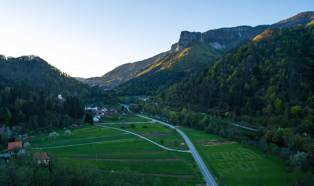
15. Brod na Kupi
The cultural and historical town of Brod na Kupi is located right next to Kupa river. Brod na Kupi when translated means the boat on the Kupa. The bridge over ...
Brod na Kupi
The cultural and historical town of Brod na Kupi is located right next to Kupa river. Brod na Kupi when translated means the boat on the Kupa. The bridge over Kupa river was built in 1809. Today it is a border crossing with the Republic of Slovenia. This beautiful small town has a shop, a primary school, a hotel and an exquisite baker shop. In the center of the town, there is a castle, which is part of the protected cultural heritage of Croatia. The caste was built in 1651 by Petar Zrinski (https://en.wikipedia.org/wiki/Petar_Zrinski). In 1670 Petar Zrinski also built the baroque church of St. Mary Magdalene with defensive walls. This preserved historical site reveals the importance of Zrinski ruler in this area. Zrinski also formed Brod na Kupi as an administrative and the judiciary center of Gorski Kotar at the time. The Kupa valley is an ideal place for an active holiday with the possibility of white water rafting. Nearby you can also visit Zeleni Vir (Green Whirpool) a geomorphological nature reserve which is ideal for cycling and unforgettable leisure walks. Sports fishermen can participate in ‘catch & release’ of brown trout (Salmo trutta), Grayling (Thymallus thymallus)
Access routs
Jelen, Ris, Smeđi medvjed
16. Izvor Kupice
Izvor Kupica (Kupica Source) is located 309m above the sea level. Kupica is 3 km long stream which flows into Kupa river. You can explore Kupica Source by reaching the ...
Izvor Kupice
Izvor Kupica (Kupica Source) is located 309m above the sea level. Kupica is 3 km long stream which flows into Kupa river. You can explore Kupica Source by reaching the village of Mala Lesnica, on the way to Brod na Kupi, then follow the signs to Mala Lesnica. The spring forms a smaller turquoise colour lake with fresh mountain water. This location is part of protected natural habitat.
Access routs
Jelen, Ris, Smeđi medvjed, Puh
17. Delnički slap
Delnički Slap or Delnice Waterfall is just a few minutes walk from the state road D203, on the way out of Delnice towards Brod na Kupi, direction. This waterfall is ...
Delnički slap
Delnički Slap or Delnice Waterfall is just a few minutes walk from the state road D203, on the way out of Delnice towards Brod na Kupi, direction. This waterfall is locally also known as Bakarčev Waterfall, named after a family from Delnice whose member, a young man, slipped from the top of the cliff with tragic consequences in the first half of 17th century. The waterfall is surrounded by tall rocks and centuries-old trees, and its charms are worth seeing.
Access routs
Jelen, Ris, Smeđi medvjed
18. Potok
The Water Well located at Potok (The Stream), along with the old stone bridge and a pool, is the fundamental feature of the old Delnice town. The Water Well was ...
Potok
The Water Well located at Potok (The Stream), along with the old stone bridge and a pool, is the fundamental feature of the old Delnice town. The Water Well was erected in 1903 as a reminder of the times when people here lived in cohesion with the forest and from the forest. Since 1800 the economy of mountain region was predominately logging, livestock farming, sawmills, woodworkers, carpenters, blacksmiths, millers and others. It was the families of Kezele, Curl and Plese responsible for building and maintaining the water well at the time, which was officially open 25th August 1903 with a statement; "Here a man can get a refreshment, the water from this stream and the stream of Jezerka means life for every inhabitant of Delnice" This was also a kind of stopping and resting point on the old trade route between the interior and the sea.
Access routs
Jelen, Ris, Smeđi medvjed
19. Veliki Drgomalj
Veliki Drgomalj - The Great Drgomalj (1154 m) is the highest peak above the Kupa Valley. The peak of Veliki Drgomalj is formed of the grassy ridge and offers beautiful ...
Veliki Drgomalj
Veliki Drgomalj - The Great Drgomalj (1154 m) is the highest peak above the Kupa Valley. The peak of Veliki Drgomalj is formed of the grassy ridge and offers beautiful views of the Kupa Valley and Kuzeljska Stijena, the cliffs rock. You can also see surrounding mountain peaks of Bitoraj, Risnjak and Snježnik. The peak itself is marked by a concrete pillar with a metal stamp an enrollment book and a mountaineer stamp with information of the location name and the height.
Access routs
Jelen, Zvjezdasti ljiljan, Tetrijeb gluhan, Sova ušara, Šojka kreštalica, Planinska sova, Kraljić, Puh
20. Hajdova hiža
Hajdova Hiža is a large cave located In the area of Veliki Drgomalj mountain, north of the town of Delnice. This cave is reachable only by skilled professional speleologists due ...
Hajdova hiža
Hajdova Hiža is a large cave located In the area of Veliki Drgomalj mountain, north of the town of Delnice. This cave is reachable only by skilled professional speleologists due to its challenging terrain. Tourists are not permitted to pass here. The cave has a rather large entrance, which is considered to be the largest underground hallway discovered in our karst (85 meters long, 27 meters wide and about 16 meters high), is just a mere illusion of passing passage, as the road further leads to extremely steep cliffs and deep, yet unseen channels.
Access routs
Jelen, Zvjezdasti ljiljan, Tetrijeb gluhan, Sova ušara, Šojka kreštalica, Troprsti djetlić, Ciklama
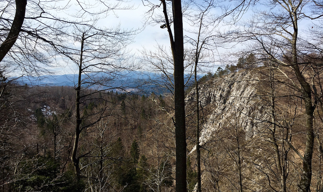
21. Jagodina stijena
The location of Jagodina Stijena (Strawberry Rock) is around 500 meters from Petehovac Mountaineering Centre hut. Jagodina Stijena or Strawberry Rock is a location at which was based on a ...
Jagodina stijena

The location of Jagodina Stijena (Strawberry Rock) is around 500 meters from Petehovac Mountaineering Centre hut. Jagodina Stijena or Strawberry Rock is a location at which was based on a love story described in the book by Milivoj Magdic from 1934. The love story which ends tragically was between Jagoda a girl from Delnice and a professor Branko Milic from Zagreb. Branko writes about his childhood summers spent in Delnice where he met Jagoda.The young couple spent time walking through the beautiful landscapes. Their love affair was passionate and profound, but Brankos work obligations and commitments take him further away and he is to marry someone else, leaving Jagoda in despair, which ended tragically as she threw herself of the Jagodina Stijena and died. The famous story brings many visitors to explore this particular location and also to admire wonderful views from Jagonina Stijena and Petehovac.
Access routs
Runolist, Šojka kreštalica, Planinska paprat, Perunika, Gorski božur, Krstokljun
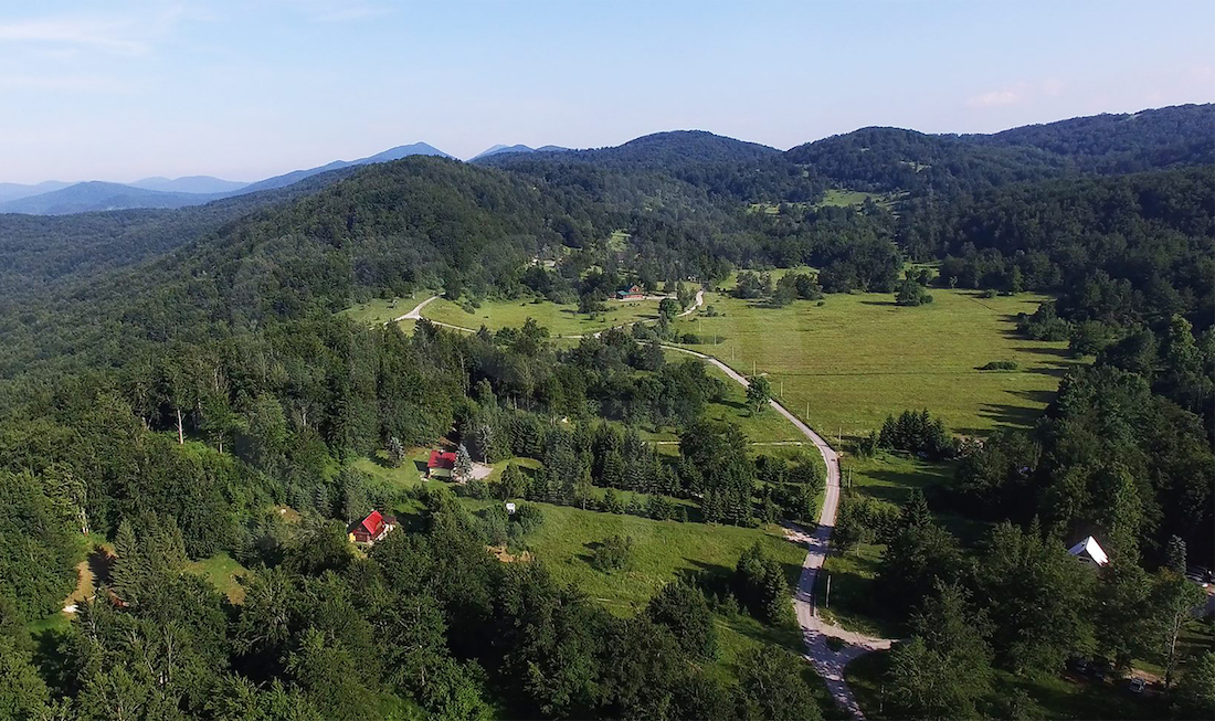
22. Štimčev vrh
Stimčev Vrh also known as Petehovac has a long tradition of catering for visitors. Apart from the cozy and comfortable restaurant hut serving great local cuisine, Petehovac also provides amazing ...
Štimčev vrh

Stimčev Vrh also known as Petehovac has a long tradition of catering for visitors. Apart from the cozy and comfortable restaurant hut serving great local cuisine, Petehovac also provides amazing views of the neighbouring peaks. On a sunny day its views can stretch all the way to the Slovenian Alps. Petehovac caters with an operation ski slope in the winter. Due to its exceptional and unspoiled natural beauty in 1963, this area was protected and declared a significant landscape. The first lodge was constructed during 1940s at Štimčev Vrh(1024m) by local volunteers. The resort itself was renamed Petehovac(1098m) after a peak south-east of Štimčev Vrh. The lodge was completed in 1945 and was renovated and extended in 1952. The resort was famous for catering international Kurikkala Competitions Cup and in 1962 the resort got the ski slopes and ski lifts (ski lift was shut down in 1986), first of its kind in Croatia. The resort also catered with the training grounds for football, basketball, handball.
Access routs
Runolist, Šojka kreštalica, Planinska paprat, Perunika, Gorski božur, Krstokljun, Šumarica
23. Mali Petehovac
The peak of Mali Petehovac (1105 m) is rich with old beech forests all around hence there are no views from its peak. Explore and enjoy this hiking trail and ...
Mali Petehovac
The peak of Mali Petehovac (1105 m) is rich with old beech forests all around hence there are no views from its peak. Explore and enjoy this hiking trail and once on the top sit and relax at the picnic table where you can sign into visitor enrollment book.
Access routs
Runolist, Šojka kreštalica, Perunika, Gorski božur, Krstokljun
24. Črmažov vrh
The top of Črmažov Vrh or Črmažov Peak (1104m) is a rocky terrain with provided table, benches and a visitor book where you can sign in. Crmazov Vrh (Peak ) ...
Črmažov vrh
The top of Črmažov Vrh or Črmažov Peak (1104m) is a rocky terrain with provided table, benches and a visitor book where you can sign in. Crmazov Vrh (Peak ) got its name from a plant known as Bear’s Garlic (lat.Alium Ursinum) which is abundant here. Just before reaching the top there is a nice view of the Bjelolasica and Mrkopalj.
Access routs
Šojka kreštalica, Perunika, Gorski božur
25. Lukanova voda
Historically, this small water stream was once an important refreshment source for people and their livestock. In the past, during the warm summer months, it was regularly used by many ...
Lukanova voda
Historically, this small water stream was once an important refreshment source for people and their livestock. In the past, during the warm summer months, it was regularly used by many who worked their fields and it was also an important water source for livestock. Today Lukanova Voda or Lukanova Water is a natural monument and a reminder to once agricultural lifestyle in and around Delnice.
Access routs
Šojka kreštalica, Krstokljun
26. Grijalica
Grijalica depression point is a natural phenomenon. It is fenced off area marked with information such as the name, altitude (892m) and the depth (28m). This depression point is located ...
Grijalica

Grijalica depression point is a natural phenomenon. It is fenced off area marked with information such as the name, altitude (892m) and the depth (28m). This depression point is located in close proximity of Delnice town, on the way to Mali & Veliki Petehovac passing Pavlakova Suta. Warm water vapour emerges from it hence it was named Grijalica (the heater). During the winter season, the snow is melted on this location due to the heat arising from Grijalica.
Access routs
Runolist, Šojka kreštalica, Krstokljun
27. Izvor jezerka
Stimcev Vrh also known as Petehovac has a long tradition of catering for visitors. Apart from the cozy and comfortable restaurant hut serving great local cuisine, Petehovac also provides amazing ...
Izvor jezerka
Stimcev Vrh also known as Petehovac has a long tradition of catering for visitors. Apart from the cozy and comfortable restaurant hut serving great local cuisine, Petehovac also provides amazing views of the neighbouring peaks. On a sunny day its views can stretch all the way to the Slovenian Alps. Petehovac caters with an operation ski slope in the winter. Due to its exceptional and unspoiled natural beauty in 1963, this area was protected and declared a significant landscape. The first lodge was constructed during 1940s at Stimcev Vrh(1024m) by local volunteers. The resort itself was renamed Petehovac(1098m) after a peak south-east of Stimcev Vrh. The lodge was completed in 1945 and was renovated and extended in 1952. The resort was famous for catering international Kurikkala Competitions Cup and in 1962 the resort got the ski slopes and ski lifts (ski lift was shut down in 1986), first of its kind in Croatia. The resort also catered with the training grounds for football, basketball, handball.
Access routs
Runolist, Šojka kreštalica, Perunika, Gorski božur, Krstokljun
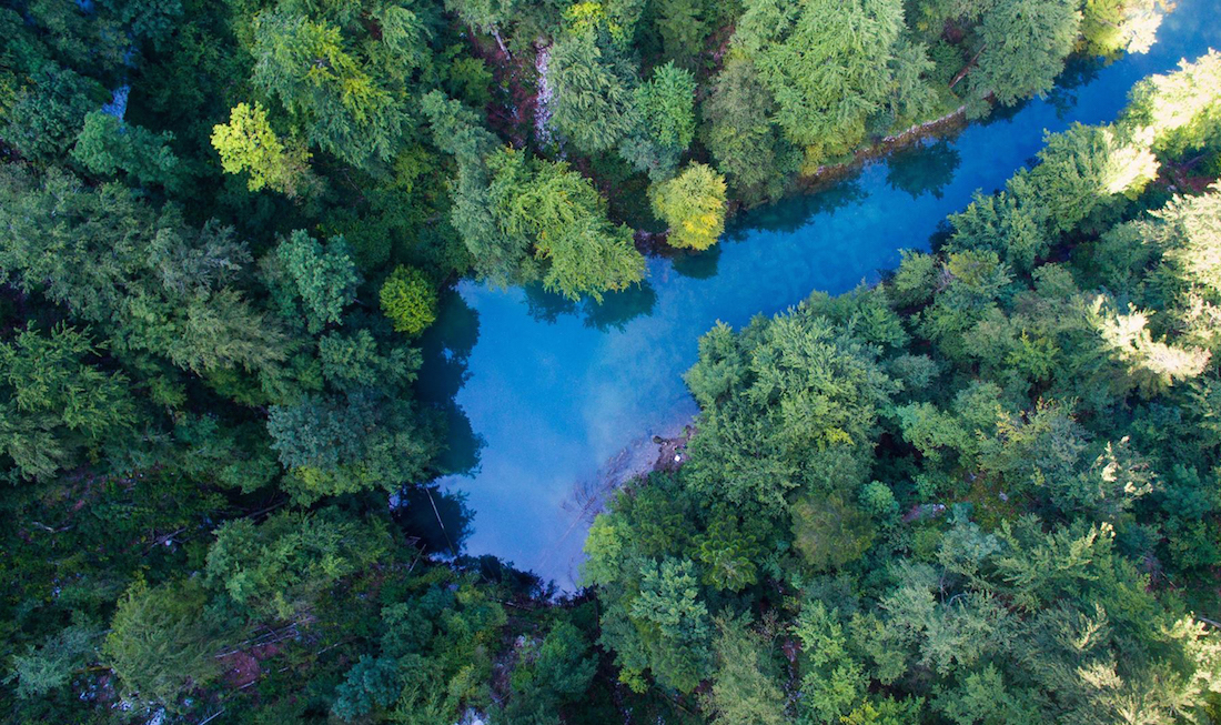
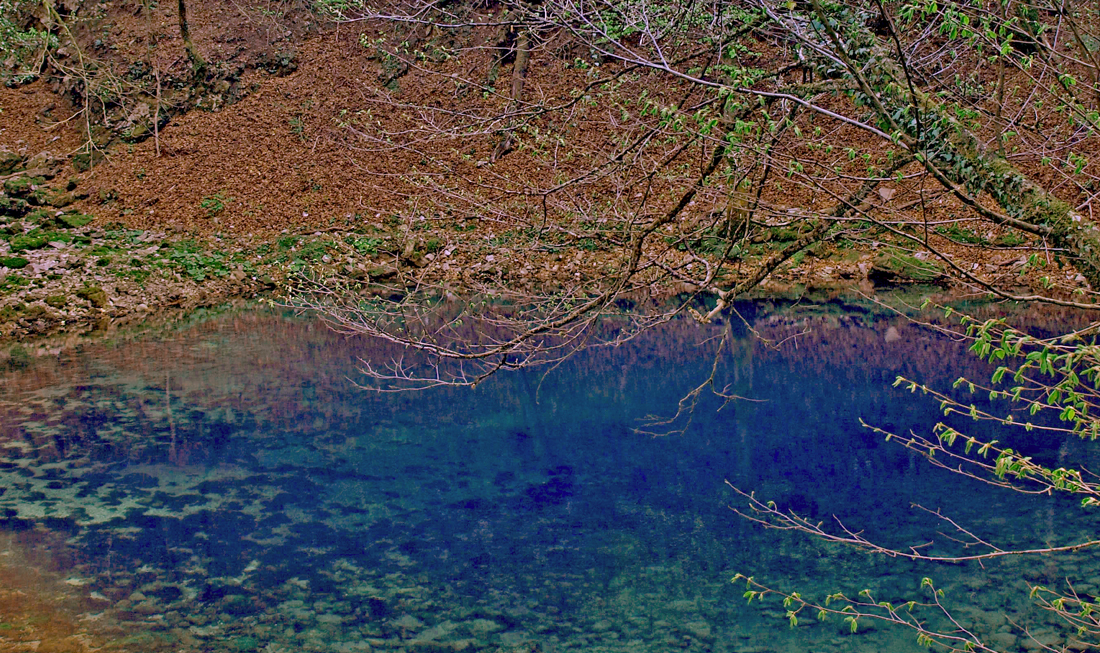
28. Izvor Kupe
Izvor Kupe or Kupa Source, an area of 10 hectares, was declared a protected natural habitat on 12th December 1963. The Kupa Source is one of many still unresolved karst ...
Izvor Kupe

Izvor Kupe or Kupa Source, an area of 10 hectares, was declared a protected natural habitat on 12th December 1963. The Kupa Source is one of many still unresolved karst mysteries. It is also one of the most water abundant and deepest Croatian springs. At an altitude of 321 m, the water emerging from an underground spring has formed a beautiful turquoise lake. The research found this spring uses two or more vertical type of canals in the shape of a vertical well to reach the top. In the summer of 2008 more scientific research was successfully achieved by one of the worlds most famous Italian diver, Luigia Casatia. On 7th August 2008, Luigia dived at the incredible depth of 154 m and did not reach the bottom. Some 30 years ago the tests have been done using special watercolour to establish the connection and the path of Kupa Spring Source. The tests showed an underground connection with Malenica spring and Velika Voda spring near Crni Lug as they both emerge at the Kupa Spring Source. The average water outflow of the source is approximately 1200 l / s, whilst maximum water quantities are not measurable. Due to the richness of flora and fauna, including an abundant variety of butterflies, the upper course of Kupa has been named the Magical Butterfly Valley. One can reach the Kupe source from two directions; via the village of Razloge which is 15 km away from Crni Lug, and/or via Kupari village,30 km away. Due to narrow roads, we recommend the entry via Razloge by car. From Razloge follow the hiking trail for 30 minutes to reach the source. The hike journey back is longer. You can also reach the source from the village of Hrvatsko (Crni Lug - Hrvatsko 45 min drive) via Kupari. (Hrvatsko - Kupari 1h 30min walk) The path from Kupari runs along the river and after 30 minutes it will bring you to the source. On your way back you can use the path that runs right along the river, parallel to the river.
Access routs
Vuk, Smeđi medvjed, Kukmasta sjenica
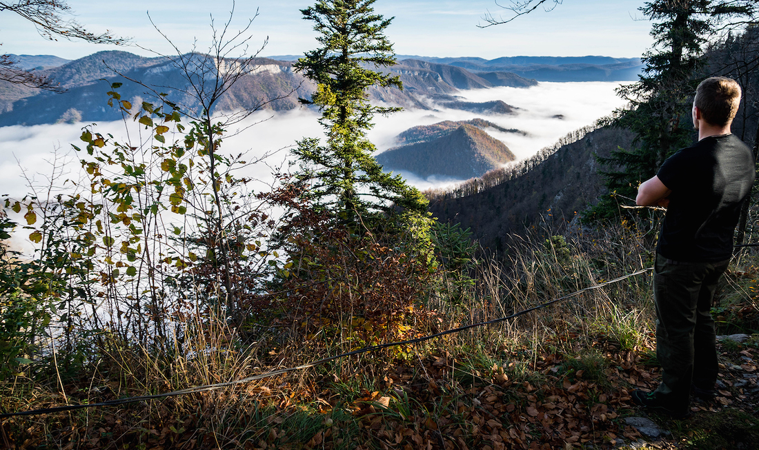
29. Risnjak
The rocky peak of Risnjak mountain (1528m) dominates over beautiful vast forests. This is the highest peak of Gorski Kotar mountain region with stunning views of the Kvarner Bay, Istria ...
Risnjak
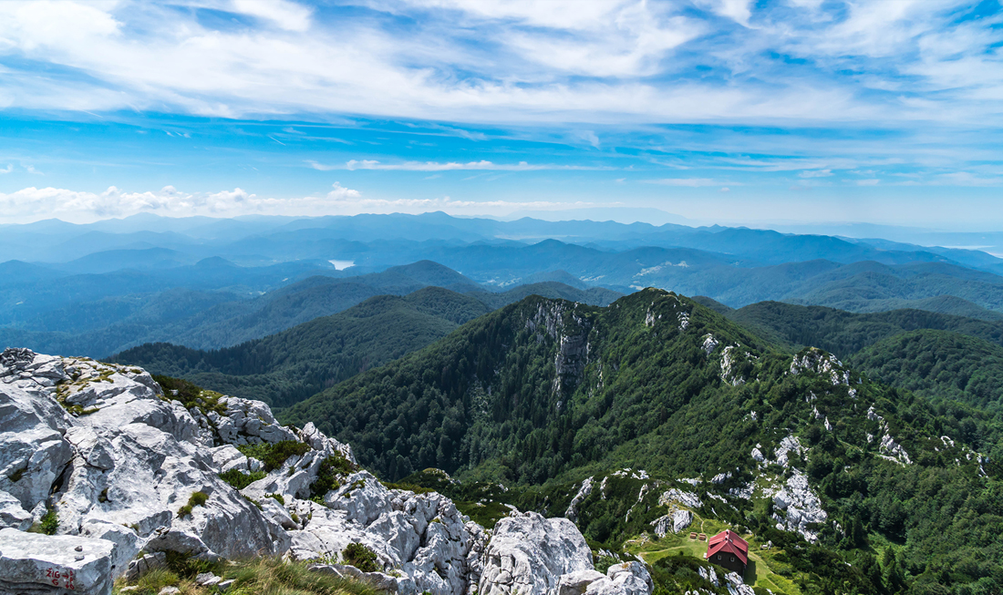
The rocky peak of Risnjak mountain (1528m) dominates over beautiful vast forests. This is the highest peak of Gorski Kotar mountain region with stunning views of the Kvarner Bay, Istria region and the Julian Alps in Slovenia. Nearby Risnjak peak there is a mountain lodge Schlosserov Dom (1418m). The lodge is fully operational from 1st May to 30th October, offering accommodation, food and drinks. For more info on opening times and entrance fees please visit http://np-risnjak.hr/ During the snowy winter months, the mountain lodge acts as a shelter only. The idea of a mountain lodge dates back to 1914. It’s implementation started in 1931 and it was officially opened on 18 September 1932. It has been renovated numerous times since.
Access routs
Planinski kos